
GNSS or Drone? Choosing the Right Tool for Precise Data Capture

This article explores when a GNSS unit is indispensable and when an unmanned aerial vehicle (UAV) saves time and money. We also highlight why using both technologies together often yields the best results.
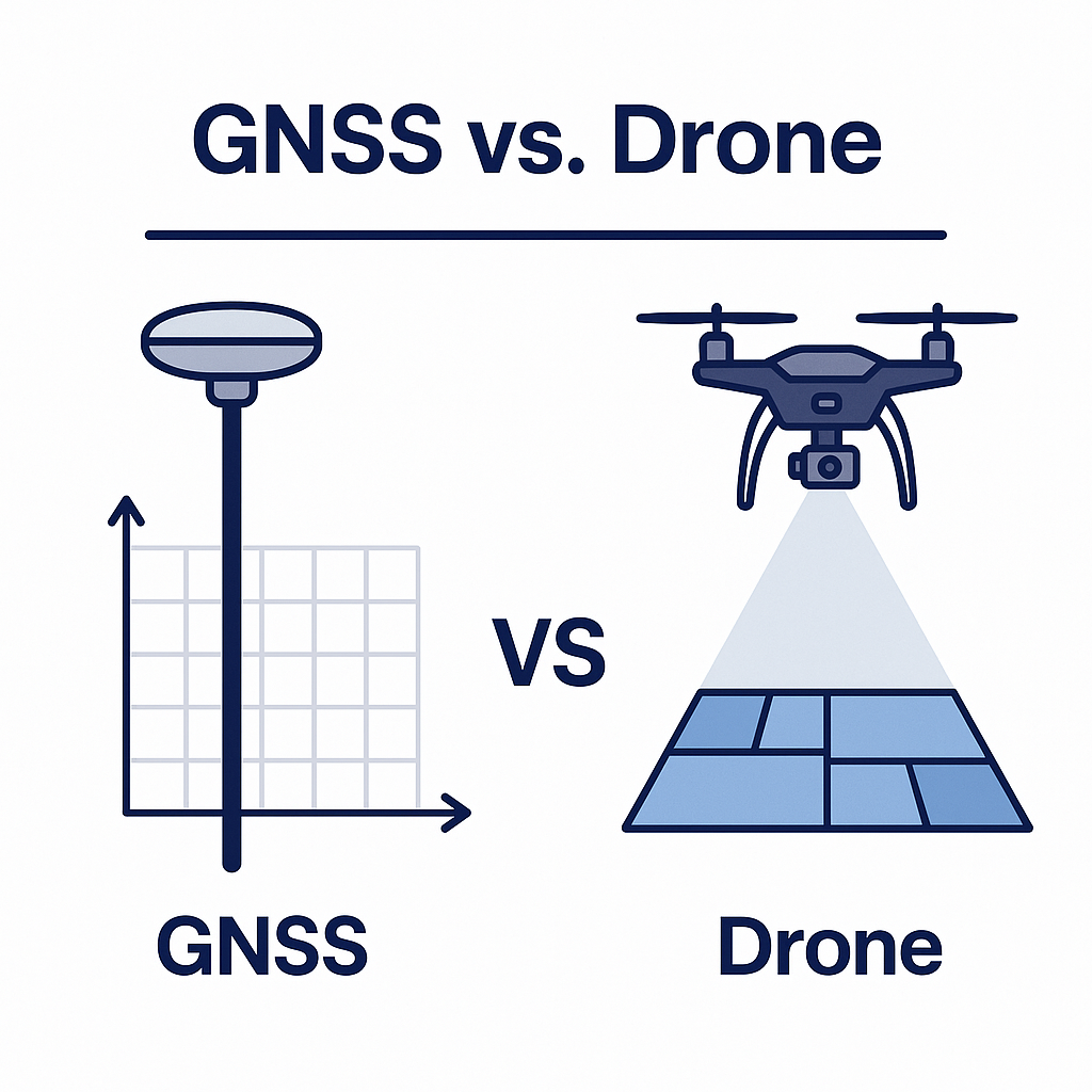
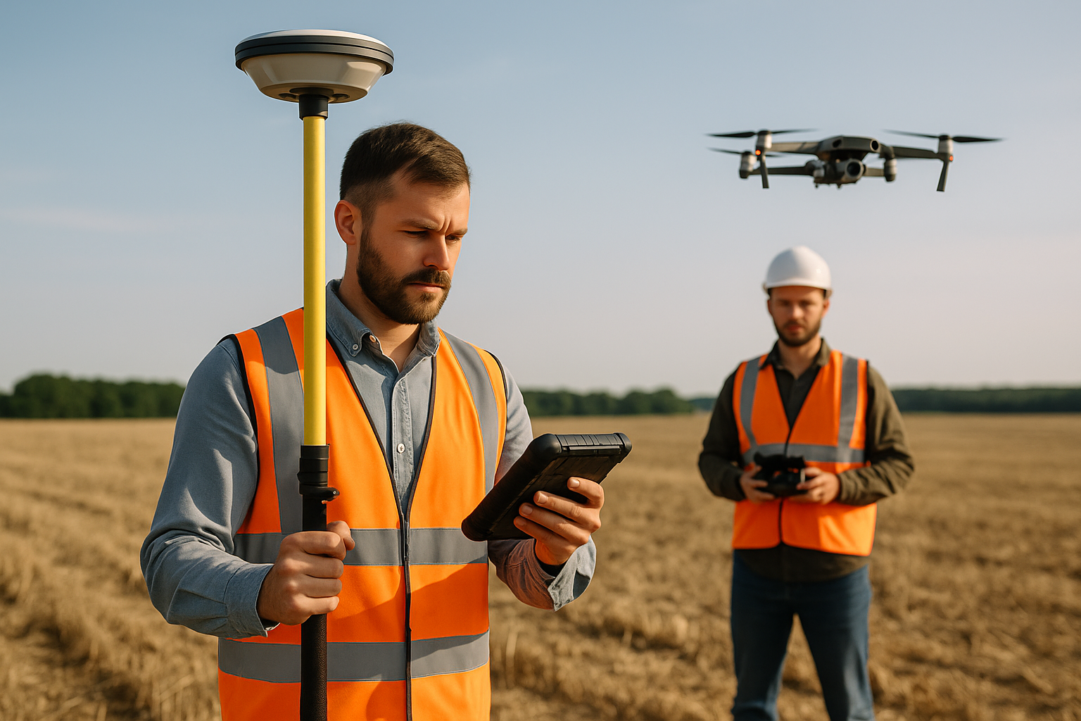
1. Different Approaches
A GNSS receiver determines coordinates on the ground by measuring signals from satellites. A drone captures a series of images from above and uses photogrammetry to create orthophotos and 3D models.
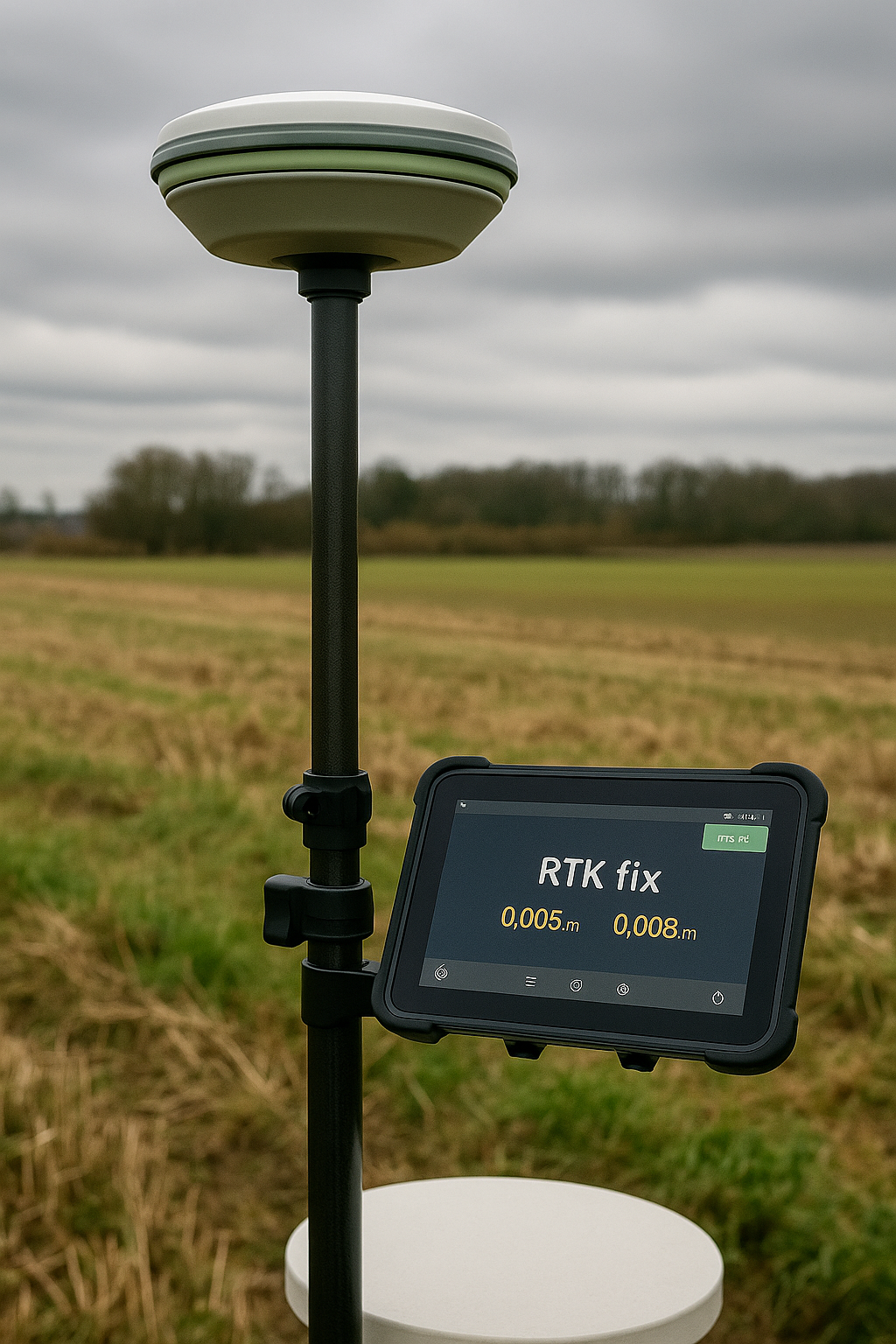
2. GNSS: Stability and Precision
GNSS surveying delivers centimeter‑level accuracy even in challenging conditions such as under tree canopies or between buildings. It’s the method of choice for cadastral boundaries, establishing control networks and creating ground control points (GCPs) for subsequent drone surveys.
Pros:
-
Accuracy up to ±1 cm (in RTK mode).
-
One surveyor can operate alone.
-
Less affected by weather or flight restrictions.
Cons:
-
Slow coverage of large areas.
-
Generates point data without visual context.
3. Drone: Speed and Visualization
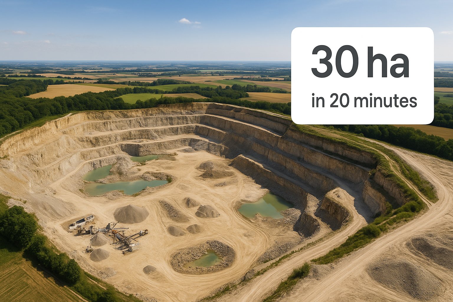
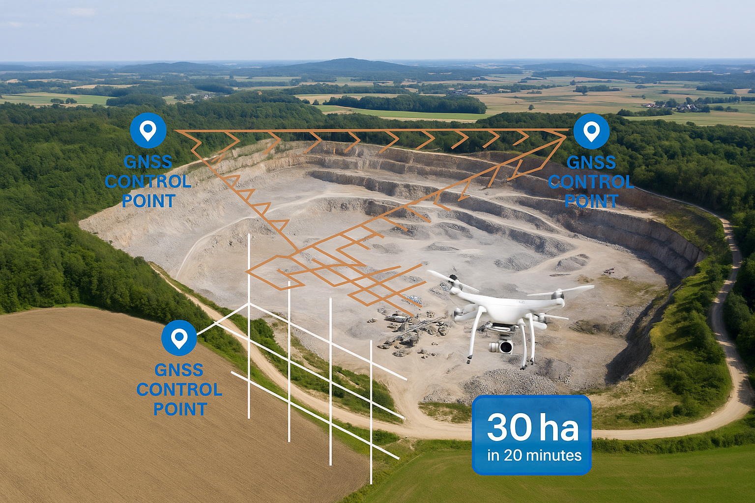
A drone is ideal for rapidly scanning large areas or complex shapes. In a single flight it can cover tens of hectares and produce orthophotos, point clouds and a digital terrain model (DTM).
Pros:
-
Fast coverage — up to 30 ha in 20 minutes.
-
Rich visualization — photos and 3D models.
-
No need to traverse the site on foot.
Cons:
-
Dependent on weather, wind and lighting.
-
Requires permits and pilot certification.
-
Initial accuracy is lower without GCPs.
4. Combining GNSS and Drone
The most accurate results come from combining both tools. GNSS receivers set ground control points, which increase the accuracy of the photogrammetric model, while the drone collects the imagery.
Benefits of integration:
-
Geo‑referenced models with ±2 cm precision.
-
80–90 % reduction in scaling errors.
-
Optimized flight plans — less time spent recalibrating.
5. Numerical Comparison
| Parameter | GNSS Surveying | Drone Surveying |
| Accuracy | ≈ ±1 cm (RTK) | 2–5 cm (with GCPs) |
| Coverage rate | 1–2 ha/hour | 30 ha/20 min |
| Weather sensitivity | Low | High |
| Visual information | Point data only | Photos + 3D model |
| Equipment cost | €2,000–3,000 | €1,500–5,000 |
| Best use cases | Geodesy, boundary control | Monitoring, 3D modelling |
6. Conclusion
GNSS and drones are not competitors but complementary tools.
-
Choose a GNSS receiver when maximum positional accuracy and boundary control are priorities.
-
Use a drone when you need rapid coverage and rich visual data.
-
The best approach combines both: GNSS for ground control points and a drone for capturing imagery and building models.
Recent post


Top‑3 GNSS Receivers for Getting Started

