
EQUIPMENT DETAILS
Product Details
Negotiations
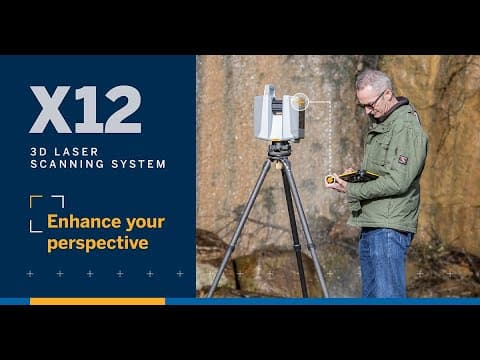

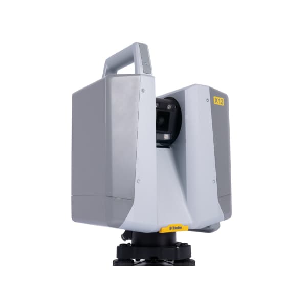

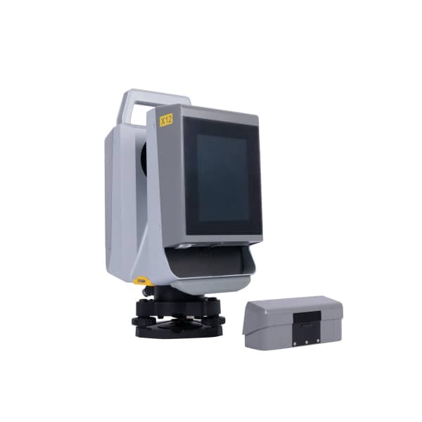
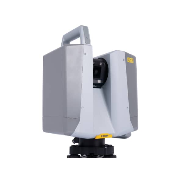
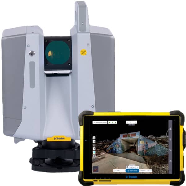
Trimble X12 High-Precision Terrestrial 3D Laser Scanner for Surveying and Reality Capture
TrimbleShowroomON REQUEST
Return & Refunds Policy
Delivery: 1–4 months after confirmation. Final timeline confirmed by our manager.
Protected by Topotronix
1. Escrow paymenti
Funds are held until the deal is verified.2. Quality Controli
Equipment can be inspected before delivery.3. Support until deliveryi
Our team supports the process until completion.ITEM'S SPECIFICS
Brand
Trimble
Model
X12
Condition
New
Year of manufacture
2026
Height, cm
35
Length, cm
26
Width, cm
26
Weight, kg
10.8
ITEM'S DESCRIPTION
The Trimble X12 is a high-precision terrestrial 3D laser scanner designed for advanced surveying, reality capture, and engineering documentation projects. The system enables fast and highly accurate collection of dense point cloud data, allowing professionals to create detailed digital representations of complex environments.
Trimble X12 combines advanced scanning technology with automated calibration and high-resolution imaging capabilities, ensuring reliable measurement accuracy and consistent data quality. The scanner is widely used for topographic surveys, construction documentation, infrastructure inspection, BIM modeling, industrial facility scanning, and heritage preservation.
The system supports efficient workflows for capturing spatial data in large or complex environments, helping professionals transform real-world objects and sites into accurate digital models.
Through the Topotronix platform, surveying companies and geospatial professionals can source advanced scanning solutions such as the Trimble X12, enabling efficient 3D data capture and high-quality point cloud generation for surveying and engineering projects.
Trimble X12 High-Precision Terrestrial 3D Laser Scanner for Surveying and Reality Capture
TrimbleShowroomON REQUEST
Return & Refunds Policy
Delivery: 1–4 months after confirmation. Final timeline confirmed by our manager.
Protected by Topotronix
1. Escrow paymenti
Funds are held until the deal is verified.2. Quality Controli
Equipment can be inspected before delivery.3. Support until deliveryi
Our team supports the process until completion.
49+Verified vendors

251+QC checks

301+Completed deals