
EQUIPMENT DETAILS
Product Details
Negotiations


Trimble MX60 Premium Mobile Mapping System with LiDAR for Advanced Surveying
TrimbleShowroomON REQUEST
Return & Refunds Policy
Delivery: 1–4 months after confirmation. Final timeline confirmed by our manager.
Protected by Topotronix
1. Escrow paymenti
Funds are held until the deal is verified.2. Quality Controli
Equipment can be inspected before delivery.3. Support until deliveryi
Our team supports the process until completion.ITEM'S SPECIFICS
Brand
Trimble
Model
MX60 Premium
Condition
New
Year of manufacture
2026
Height, cm
40
Length, cm
60
Width, cm
45
Weight, kg
27
ITEM'S DESCRIPTION
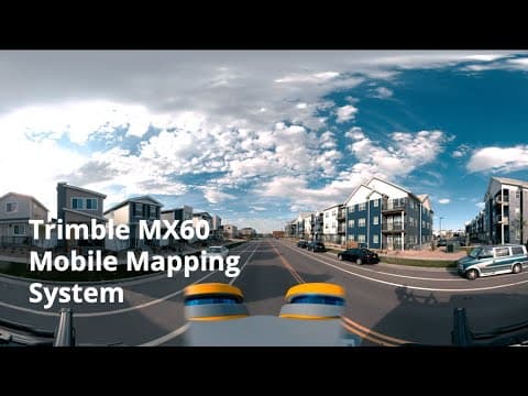
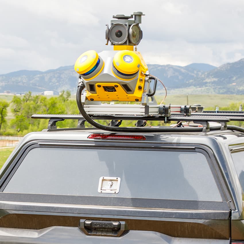
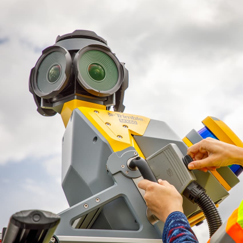
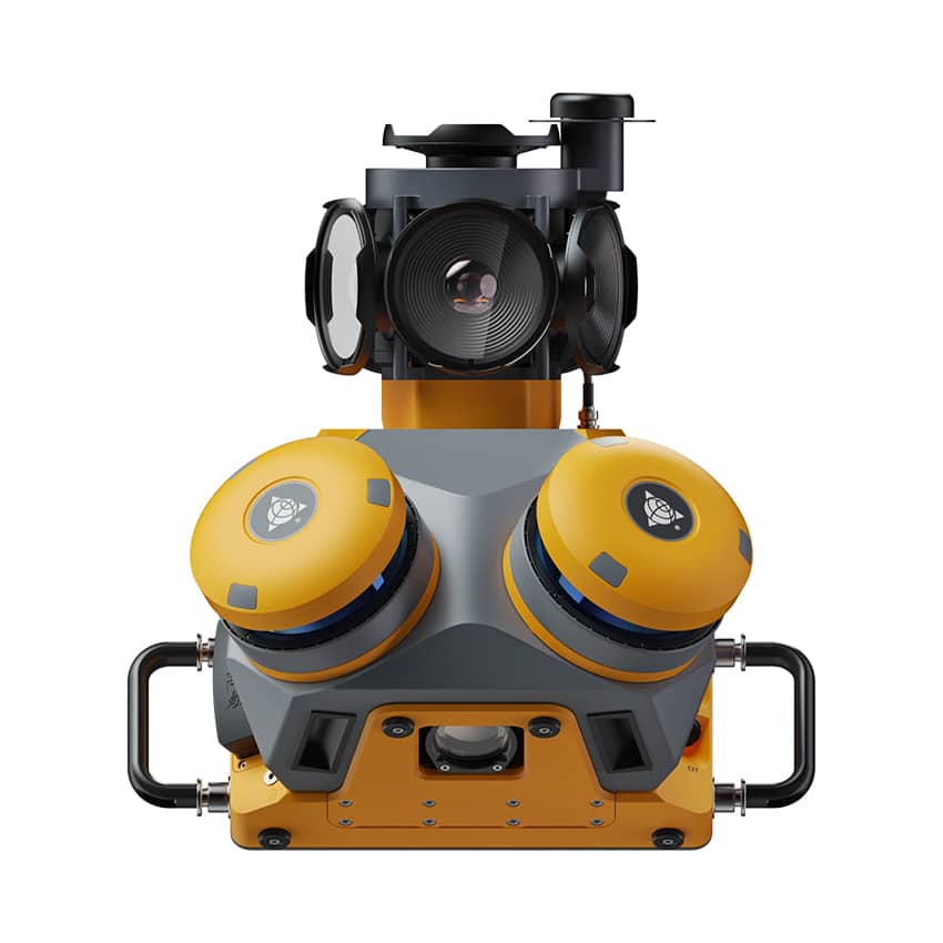
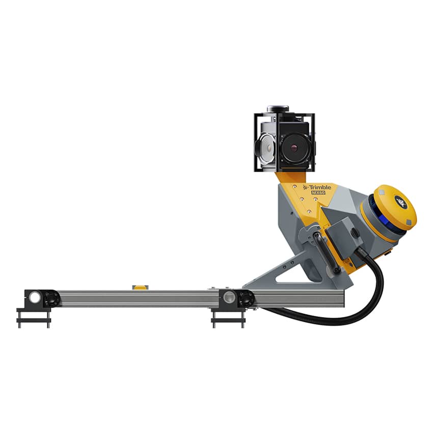
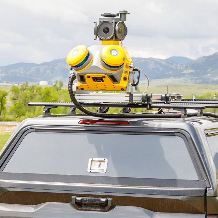
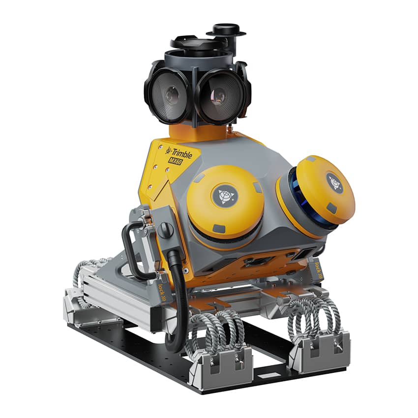
The Trimble MX60 Premium is an advanced mobile mapping system designed for high-accuracy geospatial data capture using LiDAR and integrated imaging technologies. Mounted on a vehicle, the system enables rapid collection of dense point clouds and georeferenced imagery while maintaining survey-grade positioning accuracy.
The MX60 Premium integrates high-performance LiDAR sensors, high-resolution cameras, and GNSS/INS positioning, allowing surveyors and mapping professionals to capture detailed spatial data efficiently across large areas. The system supports demanding workflows such as road corridor mapping, transportation infrastructure surveys, city-scale modeling, asset inventory, digital twin creation, and smart city mapping projects.
By enabling high-speed data acquisition while driving, the Trimble MX60 Premium significantly increases productivity compared to traditional surveying methods and allows professionals to document complex environments with exceptional detail.
Through the Topotronix platform, professionals can source advanced mobile mapping solutions such as the Trimble MX60 Premium, helping streamline geospatial data capture and large-scale infrastructure mapping projects.
Trimble MX60 Premium Mobile Mapping System with LiDAR for Advanced Surveying
TrimbleShowroomON REQUEST
Return & Refunds Policy
Delivery: 1–4 months after confirmation. Final timeline confirmed by our manager.
Protected by Topotronix
1. Escrow paymenti
Funds are held until the deal is verified.2. Quality Controli
Equipment can be inspected before delivery.3. Support until deliveryi
Our team supports the process until completion.
49+Verified vendors

251+QC checks

301+Completed deals