
EQUIPMENT DETAILS
Product Details
Negotiations


OmniSLAM Mapper
OmniSLAMShowroomON REQUEST
Return & Refunds Policy
Delivery: 1–4 months after confirmation. Final timeline confirmed by our manager.
Protected by Topotronix
1. Escrow paymenti
Funds are held until the deal is verified.2. Quality Controli
Equipment can be inspected before delivery.3. Support until deliveryi
Our team supports the process until completion.ITEM'S SPECIFICS
Brand
OmniSLAM
Model
OmniSLAM Mapper
Condition
New
Year of manufacture
2026
Height, cm
1
Length, cm
1
Width, cm
1
Weight, kg
0.01
ITEM'S DESCRIPTION
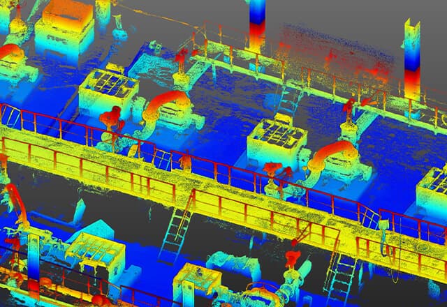
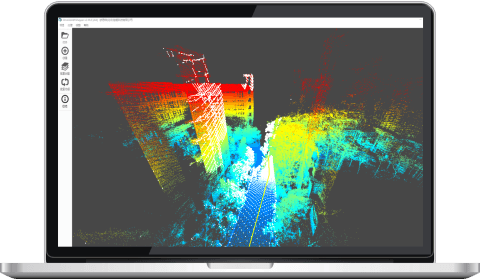
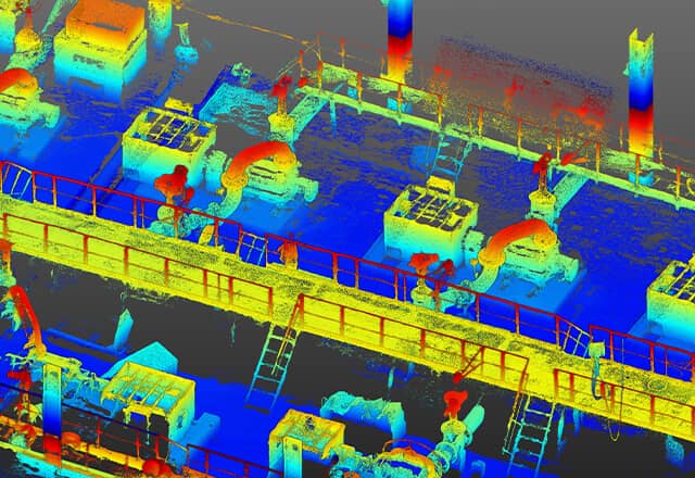
OmniSLAM Mapper is the main data processing software for OmniSLAM scanning systems. It performs point cloud processing, panoramic image integration, and spatial data reconstruction from mobile LiDAR scans. The software provides a visual processing workflow that simplifies point cloud generation and allows operators to complete complex data processing tasks efficiently. Mapper also generates accuracy evaluation reports and prepares datasets for modeling and analysis.
OmniSLAM Mapper
OmniSLAMShowroomON REQUEST
Return & Refunds Policy
Delivery: 1–4 months after confirmation. Final timeline confirmed by our manager.
Protected by Topotronix
1. Escrow paymenti
Funds are held until the deal is verified.2. Quality Controli
Equipment can be inspected before delivery.3. Support until deliveryi
Our team supports the process until completion.
49+Verified vendors

251+QC checks

301+Completed deals