


RIEGL VUX-1UAV²² Lightweight UAV LiDAR Scanner for Aerial Mapping
RIEGLShowroomITEM'S SPECIFICS
ITEM'S DESCRIPTION
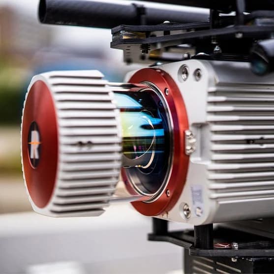
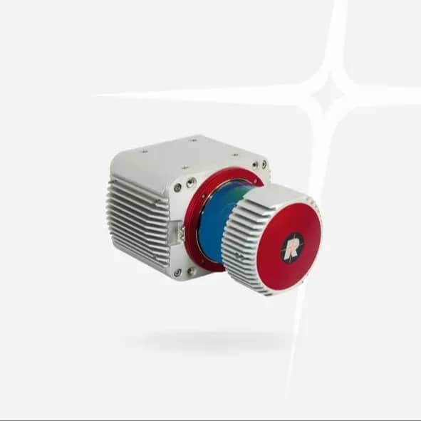
The RIEGL VUX-1UAV²² is a compact and lightweight airborne LiDAR sensor specifically designed for UAV-based laser scanning and aerial surveying missions. Its optimized design allows easy integration with UAV, RPAS, and small airborne mapping platforms, making it an ideal solution for high-precision geospatial data acquisition.
Despite its compact size, the system delivers high-performance LiDAR scanning, enabling efficient collection of dense and accurate point clouds. The sensor can be mounted in various orientations and operates with modest power consumption, making it suitable for lightweight UAV platforms and extended mapping missions.
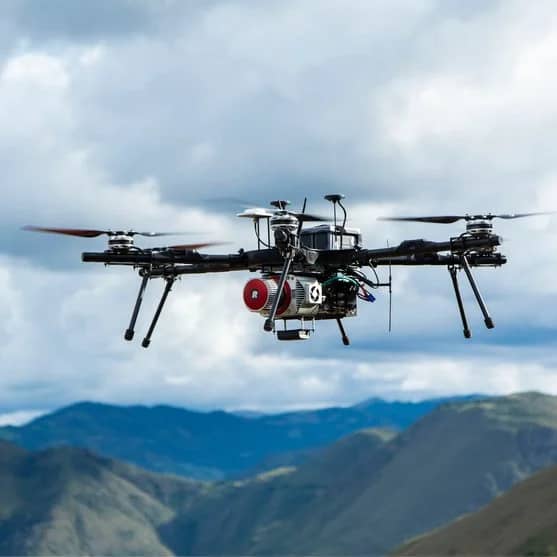
The RIEGL VUX-1UAV²² is widely used in topographic mapping, forestry surveys, infrastructure inspection, mining surveys, powerline corridor mapping, and environmental monitoring. Its reliability and flexibility make it a popular LiDAR payload for professional aerial mapping systems.
On the Topotronix platform, geospatial professionals can source advanced LiDAR survey payloads like the RIEGL VUX-1UAV²², enabling high-precision UAV mapping workflows and professional surveying operations.
RIEGL VUX-1UAV²² Lightweight UAV LiDAR Scanner for Aerial Mapping
RIEGLShowroom

