
EQUIPMENT DETAILS
Product Details
Negotiations


Trimble MX60 Pro Mobile Mapping System with LiDAR for High-Accuracy Geospatial Surveying
TrimbleShowroomON REQUEST
Return & Refunds Policy
Delivery: 1–4 months after confirmation. Final timeline confirmed by our manager.
Protected by Topotronix
1. Escrow paymenti
Funds are held until the deal is verified.2. Quality Controli
Equipment can be inspected before delivery.3. Support until deliveryi
Our team supports the process until completion.ITEM'S SPECIFICS
Brand
Trimble
Model
MX60 Pro
Condition
New
Year of manufacture
2026
Height, cm
40
Length, cm
60
Width, cm
45
Weight, kg
27
ITEM'S DESCRIPTION
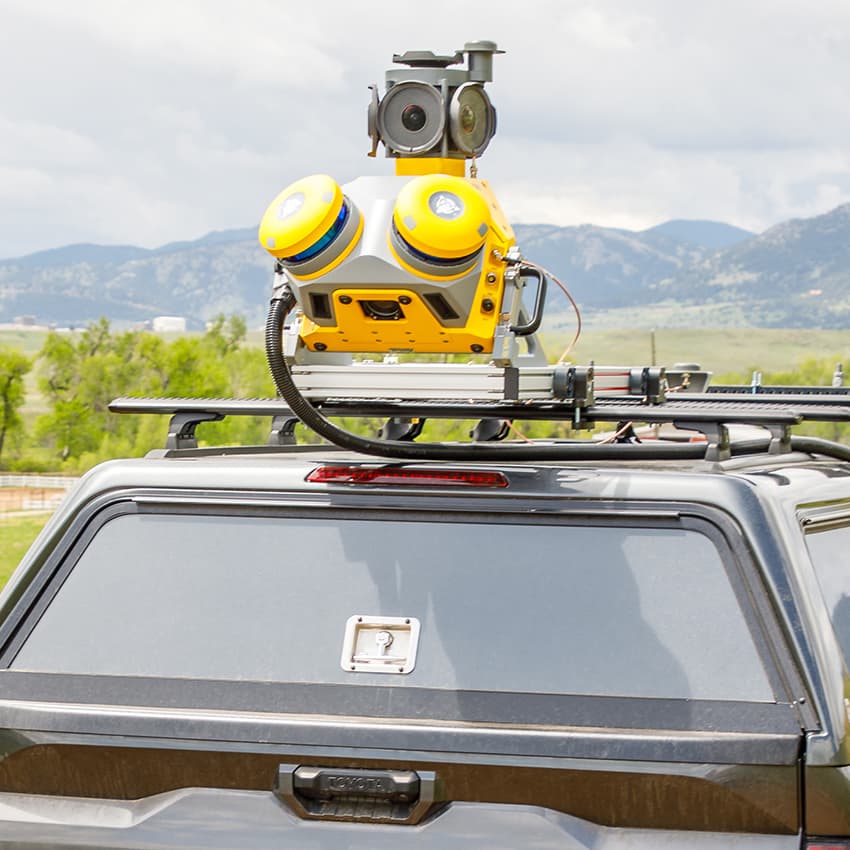
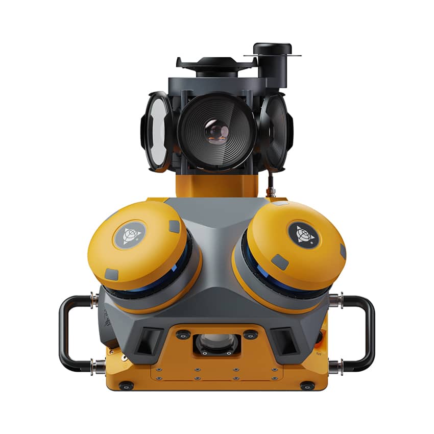
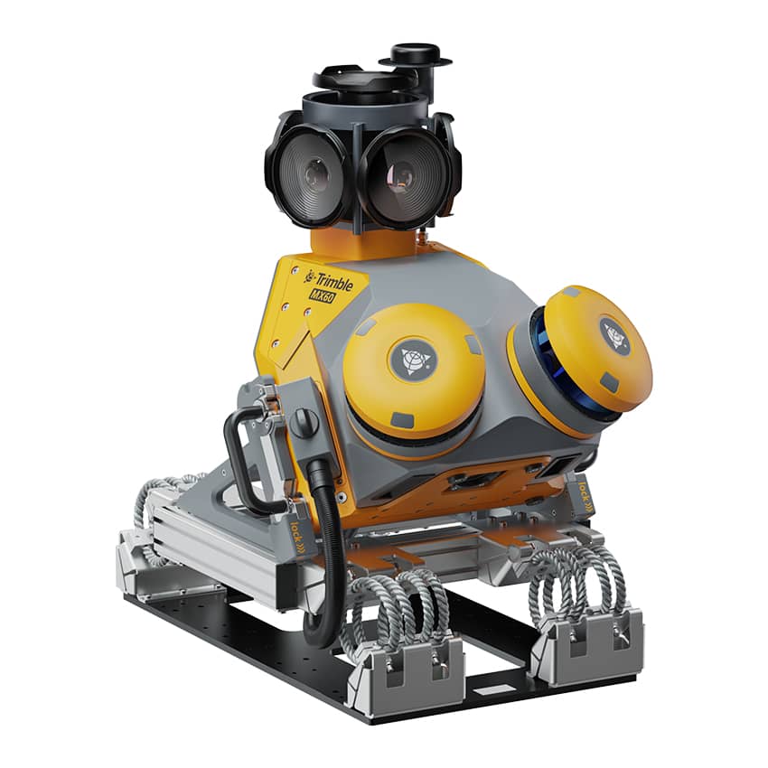
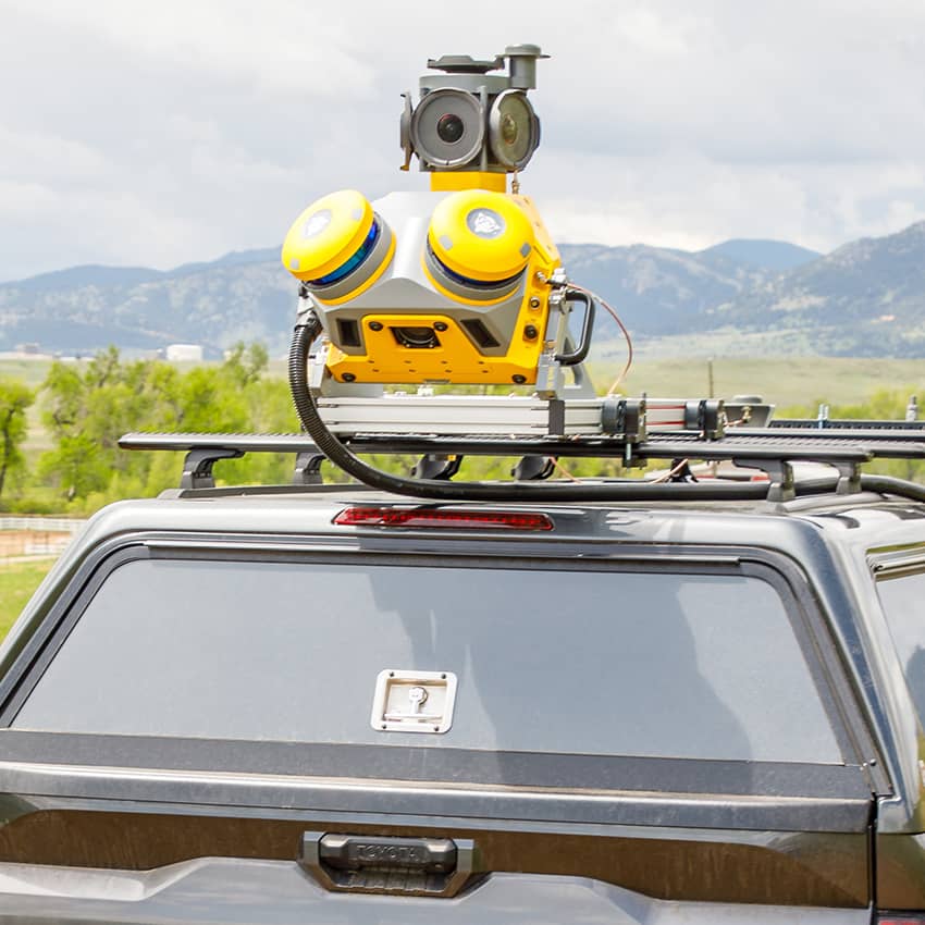
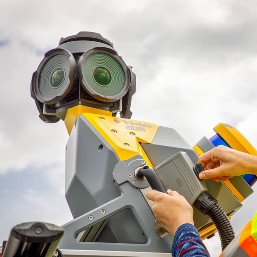
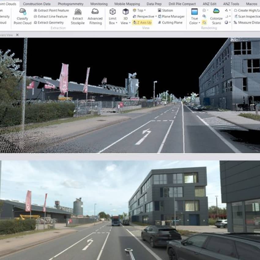
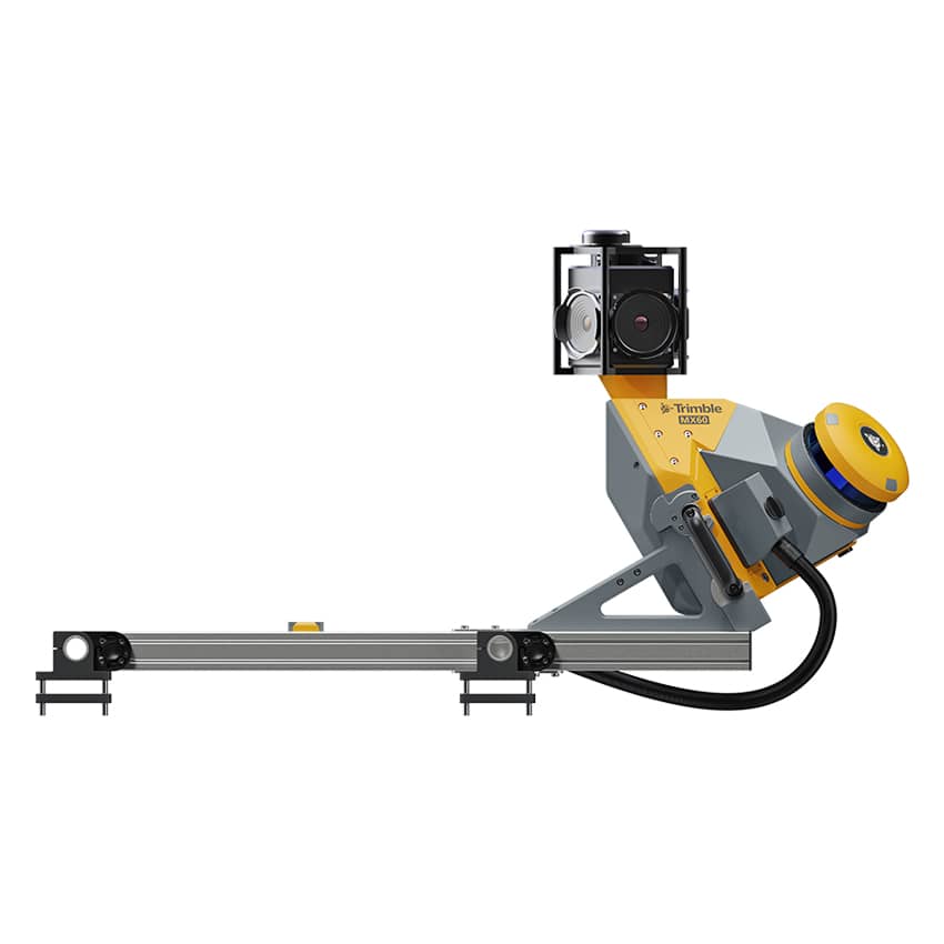
The Trimble MX60 Pro is a high-performance mobile mapping system designed for rapid and accurate collection of geospatial data in large-scale surveying projects. The system combines advanced LiDAR technology, high-resolution cameras, and GNSS/INS positioning, enabling professionals to capture dense point clouds and georeferenced imagery while mounted on a moving vehicle.
Trimble MX60 Pro is engineered for demanding applications including road corridor mapping, transportation infrastructure surveys, city modeling, asset management, digital twin development, and large-scale urban mapping. The system allows surveyors to capture highly detailed spatial data at driving speeds, significantly increasing productivity compared to traditional surveying methods.
With advanced sensor integration and reliable positioning technology, the MX60 Pro delivers precise and consistent data suitable for engineering, infrastructure planning, and smart city projects.
Through the Topotronix platform, surveying professionals can access advanced mobile mapping technologies such as the Trimble MX60 Pro, helping streamline reality capture workflows and improve efficiency in geospatial data acquisition projects.
Trimble MX60 Pro Mobile Mapping System with LiDAR for High-Accuracy Geospatial Surveying
TrimbleShowroomON REQUEST
Return & Refunds Policy
Delivery: 1–4 months after confirmation. Final timeline confirmed by our manager.
Protected by Topotronix
1. Escrow paymenti
Funds are held until the deal is verified.2. Quality Controli
Equipment can be inspected before delivery.3. Support until deliveryi
Our team supports the process until completion.
49+Verified vendors

251+QC checks

301+Completed deals