
EQUIPMENT DETAILS


ITEM'S DESCRIPTION
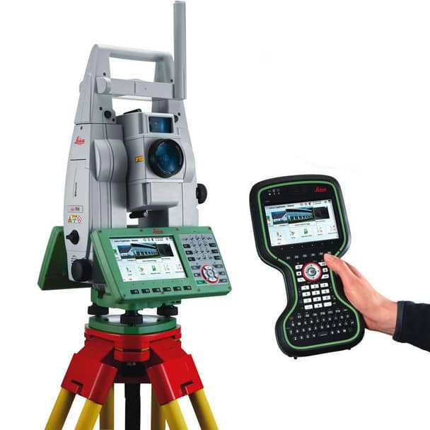
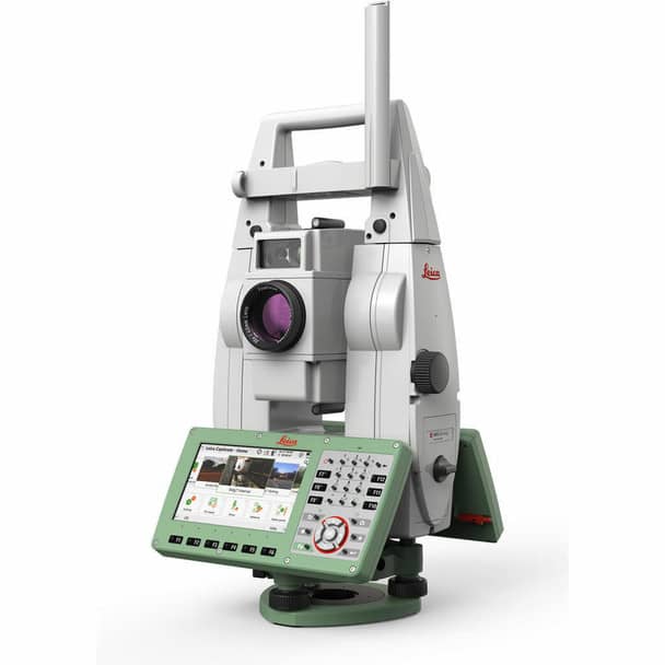
Leica SmartPole is an advanced surveying solution that combines a robotic total station with high-precision GNSS technology in a single integrated workflow. The system allows surveyors to seamlessly switch between total station measurements and GNSS positioning, providing maximum flexibility and efficiency in the field.
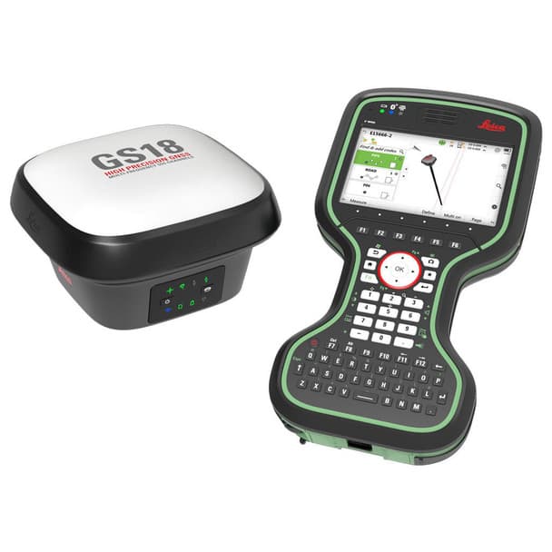
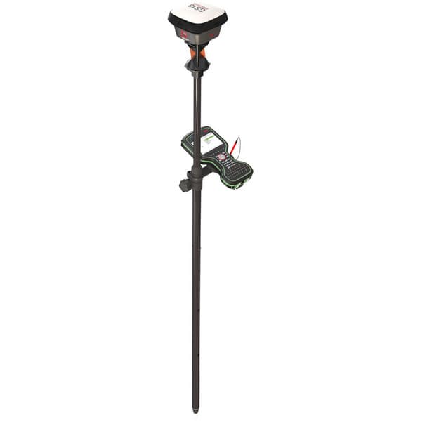
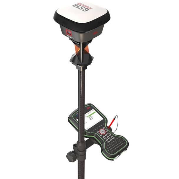
The SmartPole system typically combines the Leica TS16 robotic total station with the Leica GS18 T GNSS antenna and the Leica CS20 LTE field controller. This integrated setup allows surveyors to perform high-accuracy measurements using either GNSS or total station, or both simultaneously.
SmartPole enables on-the-fly total station setup without the need to measure orientation points beforehand. Surveyors can start measuring immediately while the system automatically determines orientation using GNSS data, significantly reducing setup time and increasing productivity.
The Leica GS18 T GNSS receiver supports multiple satellite constellations and delivers highly accurate positioning results. Combined with the robotic capabilities of the Leica TS16, the SmartPole solution provides a powerful hybrid workflow for surveying, construction layout, and engineering projects.
Leica Captivate field software provides an intuitive 3D interface for managing measurements, visualising survey data, and performing stakeout tasks directly in the field. Data can be easily transferred to Leica Infinity office software for further processing and integration into CAD or BIM environments.
Key features:
• combined GNSS and robotic total station surveying system
• seamless switching between GNSS and total station measurements
• on-the-fly total station setup without pre-measured orientation points
• Leica TS16 robotic total station with reflectorless EDM
• Leica GS18 T GNSS antenna supporting multiple satellite constellations
• Leica CS20 LTE field controller for efficient field workflows
• integration with Leica Captivate field software
• compatibility with Leica Infinity office software
Leica SmartPole significantly improves field productivity and flexibility, making it an ideal solution for construction layout, infrastructure surveying, cadastral surveys, and engineering projects.