EQUIPMENT DETAILS
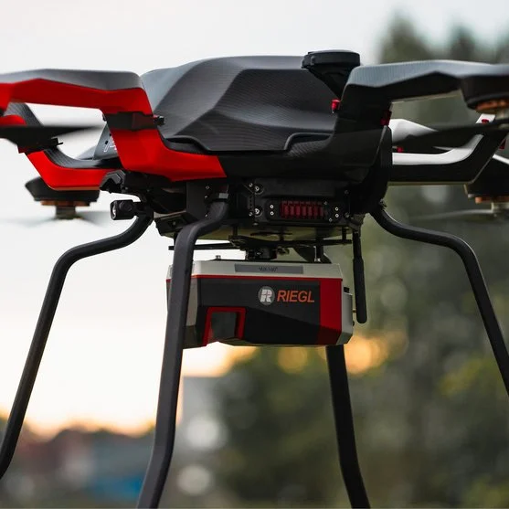
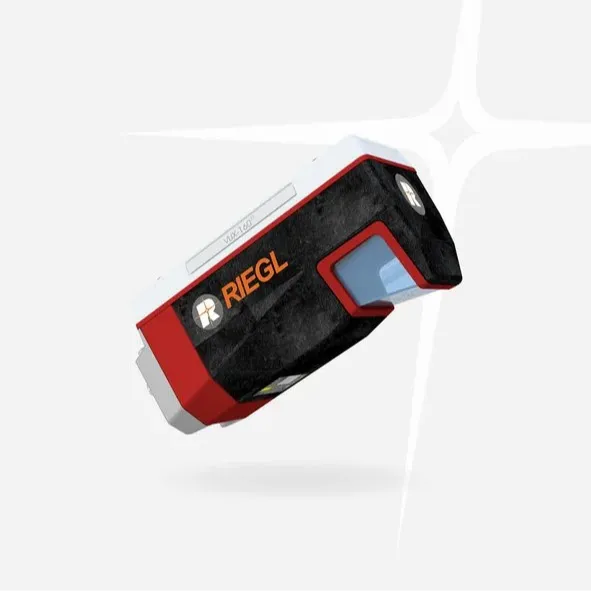
RIEGL VUX-160²³ UAV LiDAR Sensor for High-Density Corridor Mapping
RIEGL
LiDAR Survey Payloads
ShowroomITEM'S DESCRIPTION
The RIEGL VUX-160²³ is a lightweight airborne LiDAR sensor designed for UAV-based laser scanning and high-density aerial mapping applications. The system features an extremely high pulse repetition rate of up to 2.4 MHz and a wide 100° field of view, allowing efficient data capture across complex environments.
The scanner emits measurement beams consecutively in three directions — nadir, forward (+10°), and backward (-10°) — enabling exceptional data completeness, especially in environments with vertical structures, narrow corridors, or challenging terrain.
This makes the RIEGL VUX-160²³ an excellent solution for corridor mapping, infrastructure inspection, powerline surveys, railway mapping, and high-precision topographic surveys.
On the Topotronix marketplace, the RIEGL VUX-160²³ LiDAR sensor is available for professionals working in UAV mapping, geospatial surveying, and digital terrain modeling projects.


